-40%
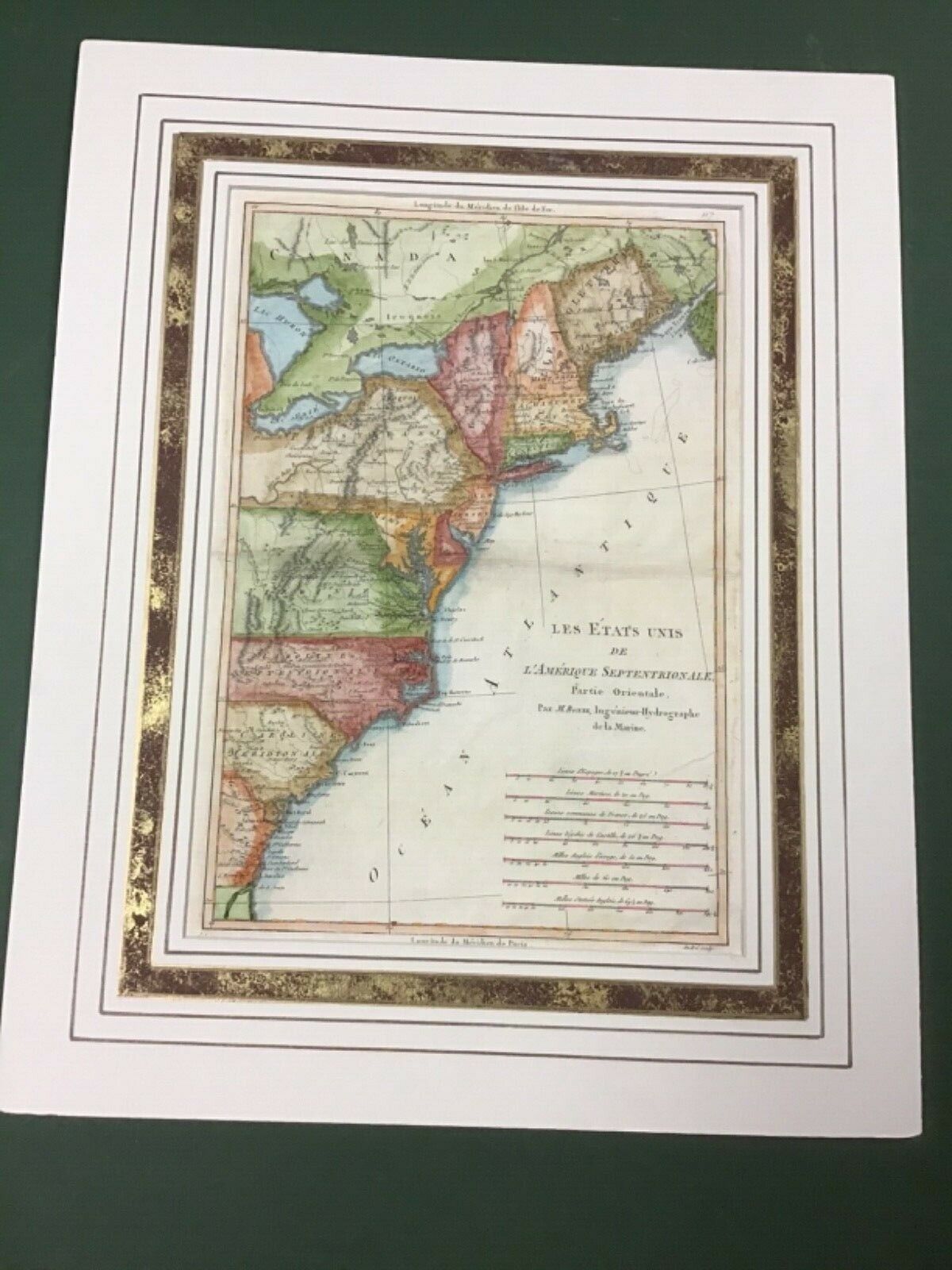
1788 Rare Handcolored Map Of U.S. Eastern Seaboard U.S.By Rigobert Boone
$ 136.75
- Description
- Size Guide
Description
This is a rare hand colored map titled “Les Etat’s Unis De L’Amerique Septentrionale,published in 1788. It was drawn by French cartographer, Rigobert Boone 1727-1794,
engraved on a copper plate by Gaspard Andre in Paris. The map came from an atlas,
so it has the center fold and printed on hand laid paper, with the full sheet measuring
17”x 11 1/2” and the plate marks measuring 14 3/8”x 10”. The map is incredibly
interesting, it shows locations of Native American tribes, forts, many misspelled
words. It was published before Rhode Island became a state in 1790. It’s beautifully
hand colored and would describe it being in very good condition, with no tears or
major stains. It’s behind a handcolored mat and will be sent well packaged and flat.
